Zip Code 96913 - Barrigada, Guam
| Primary City | Barrigada, Guam |
| Area of Zip Code 96913 | 63.9 km² |
| Population | 48,518 |
| Male Population | 25,312 (52.2%) |
| Female Population | 23,206 (47.8%) |
| Population change from 1975 to 2015 | +143.8% |
| Population change from 2000 to 2015 | +20.2% |
| Median Age | 31.7 years |
| Male Median Age | 31.8 years |
| Female Median Age | 31.6 years |
| Neighborhoods | Harmon, Upper Tumon |
| Timezone | Chamorro Standard Time |
| Coordinates | 13.477823742393506° / 144.81459630670844° |
| Related Zip Codes | 96910, 96911, 96912, 96914, 96915, 96916, 96917, 96918, 96919, 96921 |
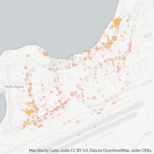
Map of Zip Code 96913 - Barrigada, Guam
Interactive Map
Zip Code 96913 - Barrigada, Guam Population
Years 1975 to 2020
| Data | 1975 | 1990 | 2000 | 2015 | 2020 |
|---|---|---|---|---|---|
| Population | 19,902 | 31,564 | 40,374 | 48,518 | 51,431 |
| Population Density | 311.3 / km² | 493.7 / km² | 631.5 / km² | 758.9 / km² | 804.5 / km² |
Zip Code 96913 - Barrigada, Guam Population change from 2000 to 2015
Increase of 20.2% from year 2000 to 2015
| Location | Change since 1975 | Change since 1990 | Change since 2000 |
|---|---|---|---|
| Zip Code 96913 - Barrigada, Guam | +143.8% | +53.7% | +20.2% |
| Barrigada | +86.7% | +29.6% | +8.2% |
Zip Code 96913 - Barrigada, Guam Median Age
Median Age: 31.7 years
| Location | Median Age | Median Age (Female) | Median Age (Male) |
|---|---|---|---|
| Zip Code 96913 - Barrigada, Guam | 31.7 yrs | 31.6 yrs | 31.8 yrs |
| Barrigada | 30.9 yrs | 32.9 yrs | 28.9 yrs |
Zip Code 96913 Population Density
Population Density: 759 / km²
| Location | Population | Area | Density |
|---|---|---|---|
| Zip Code 96913 | 48,518 | 63.9 km² | 759 / km² |
| Barrigada, Guam | 3,160 | 2.725 km² | 1,160 / km² |
Zip Code 96913 - Barrigada, Guam Historical and Projected Population
Estimated Population from 1975 to 2100
- JRC (European Commission's Joint Research Centre) work on the GHS built-up grid
- CIESIN (Center for International Earth Science Information Network)
- [Link] Klein Goldewijk, K., Beusen, A., Doelman, J., and Stehfest, E.: Anthropogenic land use estimates for the Holocene – HYDE 3.2, Earth Syst. Sci. Data, 9, 927–953, https://doi.org/10.5194/essd-9-927-2017, 2017.
Neighborhoods
Business Distribution by neighborhood in Zip Code 96913 - Barrigada, Guam
Industries
Business Distribution by Industry in Zip Code 96913 - Barrigada, Guam
| Industry Description | Number of Establishments | Average Age of Business |
|---|---|---|
| Apartments | 103 | — |
| Bars, pubs and taverns | 96 | — |
| Cafes | 84 | — |
| Car rental | 58 | — |
| Car repair | 59 | — |
| Clothing stores | 100 | — |
| Corporate management | 90 | 32 years |
| Education | 55 | 37.1 years |
| Grocery stores and supermarkets | 64 | — |
| Health and medical | 56 | 27.2 years |
| Other accommodation | 93 | 27.3 years |
| Real estate | 123 | 27.4 years |
| Restaurants | 406 | 23.8 years |
| Shopping | 202 | 28 years |
Business distribution by price for Zip Code 96913 - Barrigada, Guam
Zip Code 96913 CO2 Emissions
Carbon Dioxide (CO2) Emissions Per Capita in Tonnes Per Year
| Location | CO2 Emissions | CO2 Emissions Per Capita | CO2 Emissions Intensity |
|---|---|---|---|
| Zip Code 96913 | 879,958 tn | 18.14 tn | 13,764.6 tons/km² |
| Barrigada, Guam | 58,414 tn | 18.49 tn | 21,434.2 tons/km² |
| 2013 CO2 emissions (tonnes/year) | 879,958 tn |
| 2013 CO2 emissions (tonnes/year) per capita | 18.14 tn |
| 2013 CO2 emissions intensity (tonnes/km²/year) | 13,764.6 tons/km² |
Natural Hazards Risk
Relative risk out of 10
| Hazard | Risk Level |
|---|---|
| Drought | Medium (4) |
| Earthquake | Medium (5.4) |
| Cyclone | High (10) |
Recent Nearby Earthquakes
Magnitude 3.0 and greater
| Date▼ | Time↕ | Magnitude↕ | Distance↕ | Depth↕ | Location↕ | Link |
|---|---|---|---|---|---|---|
| 8/6/19 | 9:13 AM | 4.5 | 47.9 km | 48,760 m | 20km SSW of Merizo Village, Guam | usgs.gov |
| 7/19/19 | 12:46 AM | 4 | 40.5 km | 172,160 m | 30km NW of Piti Village, Guam | usgs.gov |
| 6/29/19 | 1:31 PM | 4.7 | 34.5 km | 48,030 m | 22km ESE of Inarajan Village, Guam | usgs.gov |
| 5/4/19 | 9:18 AM | 4.5 | 50.6 km | 102,690 m | 39km ENE of Yigo Mayor's Office, Guam | usgs.gov |
| 4/14/19 | 2:30 PM | 4.4 | 51.3 km | 198,770 m | 45km N of Yigo Village, Guam | usgs.gov |
| 3/26/19 | 4:29 AM | 4.3 | 25.1 km | 110,180 m | 17km N of Yigo Village, Guam | usgs.gov |
| 3/16/19 | 10:09 PM | 4.3 | 43.9 km | 156,940 m | 36km N of Yigo Village, Guam | usgs.gov |
| 3/16/19 | 6:10 PM | 4.2 | 46.3 km | 136,320 m | 43km NNW of Dededo Village, Guam | usgs.gov |
| 3/7/19 | 10:32 PM | 4.1 | 34 km | 131,800 m | 24km NNE of Yigo Mayor's Office, Guam | usgs.gov |
| 3/2/19 | 10:51 AM | 4.4 | 27.2 km | 119,980 m | 17km NNE of Yigo Village, Guam | usgs.gov |
Primary City
Barrigada (Chamorro: Barigåda) is a village in the United States territory of Guam. A largely residential municipality, its main village is located south of the Antonio B. Won Pat International Airport near the intersections of Routes 8, 10, and 16. ..
Barrigada, Guam Wikipedia Page
Cities
Percentage of businesses by city in Zip Code 96913 - Barrigada, Guam
About Our Data
The data on this page is estimated using a number of publicly available tools and resources. It is provided without warranty, and could contain inaccuracies. Use at your own risk.