Zip Code 2010 - Mabalacat, Central Luzon
Central Luzon | Philippines
| Primary City | Mabalacat |
| Population | 188,050 |
| Area Codes | 45 |
| Neighborhoods | Camachiles, Clark Freeport, Dau, Mabiga, San Francisco |
| Timezone | Philippine Standard Time |
| Coordinates | 15.19590881393668° / 120.59948372629415° |
| Related Zip Codes | 2000, 2011, 2012, 2013, 2014, 2015, 2016, 2017, 2018, 2019 |
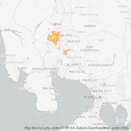
Map of Zip Code 2010 - Mabalacat, Central Luzon
Interactive Map
Philippines Population Density
Population Density: 325 / km²
| Location | Population | Area | Density |
|---|---|---|---|
| Philippines | 96.6 million | 296,939.4 km² | 325 / km² |
Sources: JRC (European Commission's Joint Research Centre) work on the GHS built-up grid
Neighborhoods
Business Distribution by neighborhood in Zip Code 2010 - Mabalacat, Central Luzon
Area Codes
Percentage Area Codes used by businesses in Zip Code 2010 - Mabalacat, Central Luzon
Business Concentration in Zip Code 2010 - Mabalacat, Central Luzon
Industries
Business Distribution by Industry in Zip Code 2010 - Mabalacat, Central Luzon
| Industry Description | Number of Establishments |
|---|---|
| Apartments | 1 |
| Beauty salons | 97 |
| Car repair | 23 |
| Clothing stores | 125 |
| Grocery stores and supermarkets | 119 |
| Hardware store | 43 |
| Restaurants | 263 |
| Shopping | 113 |
Business distribution by price for Zip Code 2010 - Mabalacat, Central Luzon
Philippines CO2 Emissions
Carbon Dioxide (CO2) Emissions Per Capita in Tonnes Per Year
| Location | CO2 Emissions | CO2 Emissions Per Capita | CO2 Emissions Intensity |
|---|---|---|---|
| Philippines | 104,920,564 tn | 1.09 tn | 353.3 tons/km² |
Sources: [Link] Moran, D., Kanemoto K; Jiborn, M., Wood, R., Többen, J., and Seto, K.C. (2018) Carbon footprints of 13,000 cities. Environmental Research Letters DOI: 10.1088/1748-9326/aac72a
Philippines CO2 Emissions
| 2013 CO2 emissions (tonnes/year) | 104,920,564 tn |
| 2013 CO2 emissions (tonnes/year) per capita | 1.09 tn |
| 2013 CO2 emissions intensity (tonnes/km²/year) | 353.3 tons/km² |
Recent Nearby Earthquakes
Magnitude 3.0 and greater
| Date▼ | Time↕ | Magnitude↕ | Distance↕ | Depth↕ | Location↕ | Link |
|---|---|---|---|---|---|---|
| 7/18/19 | 11:54 PM | 4.6 | 83.7 km | 35,000 m | 21km WSW of San Nicolas, Philippines | usgs.gov |
| 6/10/19 | 4:03 PM | 4.2 | 95.4 km | 185,490 m | 4km NNE of Naic, Philippines | usgs.gov |
| 5/5/19 | 2:27 PM | 4.4 | 91.6 km | 35,000 m | 13km WSW of Bani, Philippines | usgs.gov |
| 4/23/19 | 11:02 AM | 4.7 | 31.8 km | 50,080 m | 3km S of Lubao, Philippines | usgs.gov |
| 4/22/19 | 2:11 AM | 6.1 | 28.3 km | 21,840 m | 3km SSW of Floridablanca, Philippines | usgs.gov |
| 3/22/19 | 9:09 AM | 4.4 | 98.8 km | 10,000 m | 36km WSW of San Nicolas, Philippines | usgs.gov |
| 3/13/19 | 8:13 PM | 4.5 | 92.6 km | 49,060 m | 31km W of San Nicolas, Philippines | usgs.gov |
| 2/22/19 | 8:14 PM | 4.9 | 59.6 km | 81,620 m | 5km S of San Agustin, Philippines | usgs.gov |
| 2/7/19 | 2:28 PM | 4.3 | 53.4 km | 156,490 m | 1km SSW of Maturanoc, Philippines | usgs.gov |
| 2/6/19 | 2:25 AM | 5.5 | 73.3 km | 130,199 m | 1km NNE of Guiling, Philippines | usgs.gov |
Showing 1-10 of 419
…
Source: U.S. Geological Survey (USGS)
Primary City
Mabalacat, officially Mabalacat City (Filipino: Lungsod ng Mabalacat), is a component city in the northern part of the province of Pampanga, Philippines. Also known as Dau (from its largest barangay), the former municipality was officially converted ..
Mabalacat Wikipedia Page