Zip Code 00925 - San Juan, Puerto Rico
| Primary City | San Juan, Puerto Rico |
| Area of Zip Code 00925 | 1.134 km² |
| Population | 7,544 |
| Male Population | 3,664 (48.6%) |
| Female Population | 3,880 (51.4%) |
| Population change from 1975 to 2020 | -13.4% |
| Population change from 2000 to 2020 | -21.7% |
| Median Age | 31.7 years |
| Male Median Age | 33.6 years |
| Female Median Age | 29.9 years |
| Neighborhoods | Pueblo, Rio Piedras, Río Piedras, Santa Rita |
| Timezone | Atlantic Standard Time |
| Coordinates | 18.400330520278736° / -66.05053347488025° |
| Related Zip Codes | 00915, 00920, 00921, 00922, 00923, 00924, 00926, 00927, 00928, 00929 |
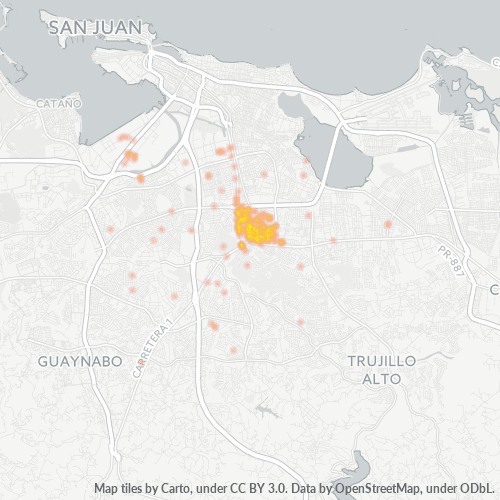
Map of Zip Code 00925 - San Juan, Puerto Rico
Interactive Map
Zip Code 00925 - San Juan, Puerto Rico Population
Years 1975 to 2030
| Data | 1975 | 1990 | 2000 | 2015 | 2020 | 2025* | 2030* |
|---|---|---|---|---|---|---|---|
| Population | 8,709 | 9,522 | 9,629 | 8,364 | 7,544 | 7,211 | 6,877 |
| Population Density | 7,683.2 / km² | 8,400.5 / km² | 8,494.9 / km² | 7,378.9 / km² | 6,655.4 / km² | 6,361.7 / km² | 6,067 / km² |
Zip Code 00925 - San Juan, Puerto Rico Population change from 2000 to 2020
Decrease of 21.7% from year 2000 to 2020
| Location | Change since 1975 | Change since 1990 | Change since 2000 |
|---|---|---|---|
| Zip Code 00925 - San Juan, Puerto Rico | -13.4% | -20.8% | -21.7% |
| San Juan | -18.4% | -25.4% | -26.1% |
Zip Code 00925 - San Juan, Puerto Rico Median Age
Median Age: 31.7 years
| Location | Median Age | Median Age (Female) | Median Age (Male) |
|---|---|---|---|
| Zip Code 00925 - San Juan, Puerto Rico | 31.7 yrs | 29.9 yrs | 33.6 yrs |
| San Juan | 39 yrs | 41 yrs | 36.6 yrs |
Zip Code 00925 Population Density
Population Density: 6,655 / km²
| Location | Population | Area | Density |
|---|---|---|---|
| Zip Code 00925 | 7,544 | 1.134 km² | 6,655 / km² |
| San Juan, Puerto Rico | 307,980 | 120.2 km² | 2,562 / km² |
Zip Code 00925 - San Juan, Puerto Rico Historical and Projected Population
Estimated Population from 1810 to 2100
- JRC (European Commission's Joint Research Centre) work on the GHS built-up grid
- CIESIN (Center for International Earth Science Information Network)
- [Link] Klein Goldewijk, K., Beusen, A., Doelman, J., and Stehfest, E.: Anthropogenic land use estimates for the Holocene – HYDE 3.2, Earth Syst. Sci. Data, 9, 927–953, https://doi.org/10.5194/essd-9-927-2017, 2017.
Neighborhoods
Business Distribution by neighborhood in Zip Code 00925 - San Juan, Puerto Rico
Industries
Business Distribution by Industry in Zip Code 00925 - San Juan, Puerto Rico
| Industry Description | Number of Establishments | Average Age of Business |
|---|---|---|
| Apartments | 19 | — |
| Bars, pubs and taverns | 26 | — |
| Beauty salons | 44 | 20.6 years |
| Cafes | 22 | — |
| Clothing stores | 24 | — |
| Department stores | 19 | — |
| Education | 57 | — |
| Health and medical | 26 | 17.2 years |
| Higher education (colleges and universities) | 28 | — |
| Lawyers legal | 71 | 21.3 years |
| Pharmacies and drug stores | 24 | — |
| Physicians and surgeons | 23 | — |
| Religion | 18 | 59 years |
| Restaurants | 101 | 15.9 years |
| Shopping | 50 | 18.1 years |
Business distribution by price for Zip Code 00925 - San Juan, Puerto Rico
Human Development Index (HDI)
Statistic composite index of life expectancy, education, and per capita income.
Zip Code 00925 CO2 Emissions
Carbon Dioxide (CO2) Emissions Per Capita in Tonnes Per Year
| Location | CO2 Emissions | CO2 Emissions Per Capita | CO2 Emissions Intensity |
|---|---|---|---|
| Zip Code 00925 | 139,455 tn | 18.49 tn | 123,029.5 tons/km² |
| San Juan, Puerto Rico | 4,960,387 tn | 16.11 tn | 41,269.8 tons/km² |
| 2013 CO2 emissions (tonnes/year) | 139,455 tn |
| 2013 CO2 emissions (tonnes/year) per capita | 18.49 tn |
| 2013 CO2 emissions intensity (tonnes/km²/year) | 123,029.5 tons/km² |
Natural Hazards Risk
Relative risk out of 10
| Hazard | Risk Level |
|---|---|
| Flood | Medium (7) |
| Earthquake | Medium (5.5) |
| Cyclone | High (9) |
Recent Nearby Earthquakes
Magnitude 3.0 and greater
| Date▼ | Time↕ | Magnitude↕ | Distance↕ | Depth↕ | Location↕ | Link |
|---|---|---|---|---|---|---|
| 5/1/19 | 6:10 PM | 4.1 | 50.8 km | 13,000 m | 1km S of El Negro, Puerto Rico | usgs.gov |
| 3/12/19 | 6:08 AM | 4.6 | 53.8 km | 13,000 m | 14km SSW of Jobos, Puerto Rico | usgs.gov |
| 1/17/19 | 9:52 PM | 3.1 | 52 km | 60,000 m | 35km NNE of Vieques, Puerto Rico | usgs.gov |
| 12/9/18 | 3:00 PM | 4.4 | 56 km | 62,000 m | 38km N of Brenas, Puerto Rico | usgs.gov |
| 10/16/18 | 2:43 PM | 3.1 | 11.5 km | 136,000 m | 3km W of Trujillo Alto, Puerto Rico | usgs.gov |
| 8/16/18 | 1:59 PM | 3.1 | 68.3 km | 3,000 m | 22km SW of Esperanza, Puerto Rico | usgs.gov |
| 7/8/18 | 11:20 PM | 3 | 57.4 km | 5,000 m | 14km SSW of Emajagua, Puerto Rico | usgs.gov |
| 5/22/18 | 9:38 PM | 3.1 | 13.7 km | 149,000 m | 1km WSW of Carolina, Puerto Rico | usgs.gov |
| 5/21/18 | 2:13 PM | 3.2 | 64.6 km | 112,000 m | 26km NNW of Culebra, Puerto Rico | usgs.gov |
| 5/10/18 | 1:06 PM | 3 | 53.1 km | 13,000 m | 11km SSE of Arroyo, Puerto Rico | usgs.gov |
Primary City
San Juan (/ˌsæn ˈhwɑːn/; Spanish pronunciation: [saŋ ˈxwan], Saint John) is the capital and most populous municipality in the Commonwealth of Puerto Rico, an unincorporated territory of the United States. As of the 2010 census, it had a population of..
San Juan, Puerto Rico Wikipedia Page
Cities
Percentage of businesses by city in Zip Code 00925 - San Juan, Puerto Rico
About Our Data
The data on this page is estimated using a number of publicly available tools and resources. It is provided without warranty, and could contain inaccuracies. Use at your own risk.