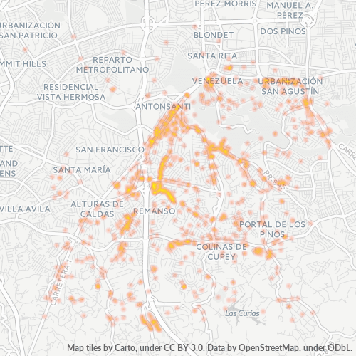
Zip Code 00926 - San Juan, Puerto Rico
| Primary City | San Juan, Puerto Rico |
| Area of Zip Code 00926 | 63.7 km² |
| Population | 86,243 |
| Male Population | 40,041 (46.4%) |
| Female Population | 46,202 (53.6%) |
| Population change from 1975 to 2020 | -17.5% |
| Population change from 2000 to 2020 | -27.0% |
| Median Age | 38.9 years |
| Male Median Age | 36.8 years |
| Female Median Age | 40.8 years |
| Neighborhoods | Cupey, Monacillo, Monacillo Urbano, Río Piedras |
| Timezone | Atlantic Standard Time |
| Coordinates | 18.346193171036468° / -66.05233121896362° |
| Related Zip Codes | 00916, 00920, 00921, 00922, 00923, 00924, 00925, 00927, 00928, 00929 |
Map of Zip Code 00926 - San Juan, Puerto Rico
Interactive Map
Zip Code 00926 - San Juan, Puerto Rico Population
Years 1975 to 2030
| Data | 1975 | 1990 | 2000 | 2015 | 2020 | 2025* | 2030* |
|---|---|---|---|---|---|---|---|
| Population | 104,579 | 115,938 | 118,193 | 104,338 | 86,243 | 82,897 | 79,466 |
| Population Density | 1,642.3 / km² | 1,820.7 / km² | 1,856.1 / km² | 1,638.5 / km² | 1,354.4 / km² | 1,301.8 / km² | 1,248 / km² |
Zip Code 00926 - San Juan, Puerto Rico Population change from 2000 to 2020
Decrease of 27% from year 2000 to 2020
| Location | Change since 1975 | Change since 1990 | Change since 2000 |
|---|---|---|---|
| Zip Code 00926 - San Juan, Puerto Rico | -17.5% | -25.6% | -27% |
| San Juan | -18.4% | -25.4% | -26.1% |
Zip Code 00926 - San Juan, Puerto Rico Median Age
Median Age: 38.9 years
| Location | Median Age | Median Age (Female) | Median Age (Male) |
|---|---|---|---|
| Zip Code 00926 - San Juan, Puerto Rico | 38.9 yrs | 40.8 yrs | 36.8 yrs |
| San Juan | 39 yrs | 41 yrs | 36.6 yrs |
Zip Code 00926 Population Density
Population Density: 1,354 / km²
| Location | Population | Area | Density |
|---|---|---|---|
| Zip Code 00926 | 86,243 | 63.7 km² | 1,354 / km² |
| San Juan, Puerto Rico | 307,980 | 120.2 km² | 2,562 / km² |
Zip Code 00926 - San Juan, Puerto Rico Historical and Projected Population
Estimated Population from 1800 to 2100
- JRC (European Commission's Joint Research Centre) work on the GHS built-up grid
- CIESIN (Center for International Earth Science Information Network)
- [Link] Klein Goldewijk, K., Beusen, A., Doelman, J., and Stehfest, E.: Anthropogenic land use estimates for the Holocene – HYDE 3.2, Earth Syst. Sci. Data, 9, 927–953, https://doi.org/10.5194/essd-9-927-2017, 2017.
Neighborhoods
Business Distribution by neighborhood in Zip Code 00926 - San Juan, Puerto Rico
Industries
Business Distribution by Industry in Zip Code 00926 - San Juan, Puerto Rico
| Industry Description | Number of Establishments | Average Age of Business |
|---|---|---|
| Apartments | 98 | — |
| Beauty salons | 114 | 14.1 years |
| Car repair | 78 | 20.4 years |
| Churches | 108 | 15.1 years |
| Clothing stores | 74 | 13.2 years |
| Corporate management | 151 | 24 years |
| Education | 156 | 28 years |
| Health and medical | 107 | 18.4 years |
| Real estate | 79 | 22.4 years |
| Religion | 76 | 32.7 years |
| Restaurants | 287 | 17.6 years |
| Shopping | 189 | 26.4 years |
| Travel and transportation | 72 | — |
Business distribution by price for Zip Code 00926 - San Juan, Puerto Rico
Human Development Index (HDI)
Statistic composite index of life expectancy, education, and per capita income.
Zip Code 00926 - San Juan, Puerto Rico Gross Domestic Product (GDP)
GDP per capita, PPP (constant 2017 international $)
| Data | 1990 | 1995 | 2000 | 2005 | 2010 | 2015 | 2020 | 2022 |
|---|---|---|---|---|---|---|---|---|
| GDP per capita | $19,850 | $23,215 | $29,690 | $34,754 | $32,785 | $33,035 | $33,044 | $34,908 |
| Total GDP | $4.4B | $5.2B | $6.7B | $7.6B | $6.9B | $6.7B | $5.8B | $6B |
Zip Code 00926 CO2 Emissions
Carbon Dioxide (CO2) Emissions Per Capita in Tonnes Per Year
| Location | CO2 Emissions | CO2 Emissions Per Capita | CO2 Emissions Intensity |
|---|---|---|---|
| Zip Code 00926 | 1,594,247 tn | 18.49 tn | 25,036.4 tons/km² |
| San Juan, Puerto Rico | 4,960,387 tn | 16.11 tn | 41,269.8 tons/km² |
| 2013 CO2 emissions (tonnes/year) | 1,594,247 tn |
| 2013 CO2 emissions (tonnes/year) per capita | 18.49 tn |
| 2013 CO2 emissions intensity (tonnes/km²/year) | 25,036.4 tons/km² |
Natural Hazards Risk
Relative risk out of 10
| Hazard | Risk Level |
|---|---|
| Flood | Medium (7) |
| Earthquake | Medium (5.9) |
| Cyclone | High (9) |
Recent Nearby Earthquakes
Magnitude 3.0 and greater
| Date▼ | Time↕ | Magnitude↕ | Distance↕ | Depth↕ | Location↕ | Link |
|---|---|---|---|---|---|---|
| 5/1/19 | 6:10 PM | 4.1 | 45.7 km | 13,000 m | 1km S of El Negro, Puerto Rico | usgs.gov |
| 3/12/19 | 6:08 AM | 4.6 | 48 km | 13,000 m | 14km SSW of Jobos, Puerto Rico | usgs.gov |
| 1/17/19 | 9:52 PM | 3.1 | 56.6 km | 60,000 m | 35km NNE of Vieques, Puerto Rico | usgs.gov |
| 12/9/18 | 3:00 PM | 4.4 | 60.7 km | 62,000 m | 38km N of Brenas, Puerto Rico | usgs.gov |
| 10/16/18 | 2:43 PM | 3.1 | 5.9 km | 136,000 m | 3km W of Trujillo Alto, Puerto Rico | usgs.gov |
| 8/16/18 | 1:59 PM | 3.1 | 64.2 km | 3,000 m | 22km SW of Esperanza, Puerto Rico | usgs.gov |
| 7/8/18 | 11:20 PM | 3 | 51.7 km | 5,000 m | 14km SSW of Emajagua, Puerto Rico | usgs.gov |
| 5/22/18 | 9:38 PM | 3.1 | 14.4 km | 149,000 m | 1km WSW of Carolina, Puerto Rico | usgs.gov |
| 5/21/18 | 2:13 PM | 3.2 | 66 km | 112,000 m | 26km NNW of Culebra, Puerto Rico | usgs.gov |
| 5/10/18 | 12:48 PM | 3.9 | 46.4 km | 13,000 m | 11km SSE of Arroyo, Puerto Rico | usgs.gov |
Primary City
San Juan (/ˌsæn ˈhwɑːn/; Spanish pronunciation: [saŋ ˈxwan], Saint John) is the capital and most populous municipality in the Commonwealth of Puerto Rico, an unincorporated territory of the United States. As of the 2010 census, it had a population of..
San Juan, Puerto Rico Wikipedia Page
About Our Data
The data on this page is estimated using a number of publicly available tools and resources. It is provided without warranty, and could contain inaccuracies. Use at your own risk.