Zip Code 62353 - Hersman, Illinois
| Primary City | Hersman, Illinois |
| Area of Zip Code 62353 | 187.4 sq mi |
| Population | 5,192 |
| Male Population | 3,499 (67.4%) |
| Female Population | 1,693 (32.6%) |
| Population change from 1975 to 2020 | -1.9% |
| Population change from 2000 to 2020 | -8.2% |
| Median Age | 36.4 years |
| Male Median Age | 34.6 years |
| Female Median Age | 40.2 years |
| Neighborhoods | Mt Sterling |
| Timezone | Central Daylight Time |
| Coordinates | 39.972559075846746° / -90.75820603111667° |
| Related Zip Codes | 62341, 62343, 62351, 62352, 62354, 62355, 62356, 62357, 62358, 62359 |
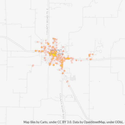
Map of Zip Code 62353 - Hersman, Illinois
Interactive Map
Zip Code 62353 - Hersman, Illinois Population
Years 1975 to 2030
| Data | 1975 | 1990 | 2000 | 2015 | 2020 | 2025* | 2030* |
|---|---|---|---|---|---|---|---|
| Population | 5,292 | 5,544 | 5,656 | 5,612 | 5,192 | 5,143 | 4,835 |
| Population Density | 10.9 / km² | 11.4 / km² | 11.7 / km² | 11.6 / km² | 10.7 / km² | 10.6 / km² | 10 / km² |
Racial demographics for Zip Code 62353 - Hersman, Illinois
Zip Code 62353 - Hersman, Illinois Population change from 2000 to 2020
Decrease of 8.2% from year 2000 to 2020
| Location | Change since 1975 | Change since 1990 | Change since 2000 |
|---|---|---|---|
| Zip Code 62353 - Hersman, Illinois | -1.9% | -6.3% | -8.2% |
| Illinois | +16.2% | +9.2% | +3.4% |
| United States | — | — | — |
Zip Code 62353 - Hersman, Illinois Median Age
Median Age: 36.4 years
| Location | Median Age | Median Age (Female) | Median Age (Male) |
|---|---|---|---|
| Zip Code 62353 - Hersman, Illinois | 36.4 yrs | 40.2 yrs | 34.6 yrs |
| Illinois | 36.6 yrs | 37.9 yrs | 35.3 yrs |
| United States | 37.4 yrs | 38.7 yrs | 36.1 yrs |
Zip Code 62353 Population Density
Population Density: 27.7 / mi²
| Location | Population | Area | Density |
|---|---|---|---|
| Zip Code 62353 | 5,192 | 187.4 sq mi | 27.7 / mi² |
| Illinois | 12.9 million | 57,913.5 sq mi | 223 / mi² |
| United States | 321.6 million | 3,796,740.8 sq mi | 84.7 / mi² |
Zip Code 62353 - Hersman, Illinois Historical and Projected Population
Estimated Population from 1830 to 2100
- JRC (European Commission's Joint Research Centre) work on the GHS built-up grid
- CIESIN (Center for International Earth Science Information Network)
- [Link] Klein Goldewijk, K., Beusen, A., Doelman, J., and Stehfest, E.: Anthropogenic land use estimates for the Holocene – HYDE 3.2, Earth Syst. Sci. Data, 9, 927–953, https://doi.org/10.5194/essd-9-927-2017, 2017.
| Population | 5,192 |
| Households in Zip Code 62353 - Hersman, Illinois | 1,781 |
| People per Household | 2.3 |
| Average House Value | $50,300 |
| Income per Household | $33,958 |
Industries
Business Distribution by Industry in Zip Code 62353 - Hersman, Illinois
| Industry Description | Number of Establishments | Average Age of Business |
|---|---|---|
| Beauty salons | 28 | 29.6 years |
| Car repair | 5 | 46 years |
| Construction of buildings | 6 | 27.4 years |
| Lawyers legal | 3 | 22.6 years |
| Religion | 2 | 99.1 years |
| Restaurants | 7 | 42 years |
| Shopping | 2 | 23.6 years |
| Businesses | 1,766 |
| Estimated total revenue | ~$1.8B |
| Median revenue per business | ~$459.5K |
| Estimated jobs | 2,065 |
| Estimated payroll | ~$96.1M |
| Industries | Businesses | Total revenue | Median | Jobs |
|---|---|---|---|---|
| Transportation and storage | 48 | ~$1.6B | ~$894.5K | 548 |
| Wholesale and retail trade; repair of motor vehicles and motorcycles | 113 | ~$83.3M | ~$490.9K | 193 |
| Human health and social work activities | 84 | ~$27.4M | ~$683.7K | 250 |
| Construction | 49 | ~$15.4M | ~$775.8K | 80 |
| Other service activities | 143 | ~$15.3M | ~$307.3K | 152 |
| Arts, entertainment and recreation | 55 | ~$10.6M | ~$402.7K | 92 |
| Education | 23 | ~$9.9M | ~$895.7K | 107 |
| Professional, scientific and technical activities | 53 | ~$9.1M | ~$538.7K | 35 |
Largest businesses by estimated revenue
- Dot Foods, Inc. — Mount Sterling, Illinois · ~$1.5B
- Hills Industries — Hersman, Illinois · ~$37.5M
- Nutrien Ag Solutions — Hersman, Illinois · ~$19.6M
- Parallel Ag — Hersman, Illinois · ~$15.6M
- Dot Transportation Inc — Hersman, Illinois · ~$14.2M
Zip Code 62353 - Hersman, Illinois — Revenue trend
Median business revenue by year
| Year | 2019 | 2020 | 2021 | 2022 | 2023 | 2024 |
|---|---|---|---|---|---|---|
| Median revenue per business | ~$446.3K | ~$441.2K | ~$638.2K | ~$526.8K | ~$556.6K | ~$676.8K |
Business distribution by price for Zip Code 62353 - Hersman, Illinois
Human Development Index (HDI)
Statistic composite index of life expectancy, education, and per capita income.
Zip Code 62353 - Hersman, Illinois Gross Domestic Product (GDP)
GDP per capita, PPP (constant 2017 international $)
| Data | 1990 | 1995 | 2000 | 2005 | 2010 | 2015 | 2020 | 2022 |
|---|---|---|---|---|---|---|---|---|
| GDP per capita | $23,184 | $24,235 | $27,107 | $32,152 | $34,806 | $37,995 | $35,866 | $36,093 |
| Total GDP | $117.8M | $125.6M | $136.3M | $161.7M | $175.8M | $187.3M | $165.4M | $165.8M |
Zip Code 62353 CO2 Emissions
Carbon Dioxide (CO2) Emissions Per Capita in Tonnes Per Year
| Location | CO2 Emissions | CO2 Emissions Per Capita | CO2 Emissions Intensity |
|---|---|---|---|
| Zip Code 62353 | 71,091 tn | 13.69 tn | 379.4 tons/mi² |
| Illinois | 258,230,858 tn | 20 tn | 4,458.9 tons/mi² |
| United States | 5,664,619,810 tn | 17.62 tn | 1,492 tons/mi² |
| 2013 CO2 emissions (tonnes/year) | 71,091 tn |
| 2013 CO2 emissions (tonnes/year) per capita | 13.69 tn |
| 2013 CO2 emissions intensity (tonnes/mi²/year) | 379.4 tons/mi² |
Natural Hazards Risk
Relative risk out of 10
| Hazard | Risk Level |
|---|---|
| Flood | High (10) |
Recent Nearby Earthquakes
Magnitude 3.0 and greater
| Date▼ | Time↕ | Magnitude↕ | Distance↕ | Depth↕ | Location↕ | Link |
|---|---|---|---|---|---|---|
| 7/18/09 | 8:34 PM | 4.8 | 69.4 km | — | Illinois | usgs.gov |
Primary City
Hersman is an unincorporated community in Brown County, Illinois, United States. Hersman is located on Illinois Route 99, southeast of Mount Sterling.
Hersman, Illinois Wikipedia PageAbout Our Data
The data on this page is estimated using a number of publicly available tools and resources. It is provided without warranty, and could contain inaccuracies. Use at your own risk.